|
|
|||
|
|
|
|
|
|
|
|||
WALK TRAILS - PERTH AND BEYOND
|
|
|
|
|
|
WE NEED YOUR SUPPORT. |
|
|
|
|
Select a page
Perth and Suburban Trails | Darling Range | Coastal Walks | South West | Bibbulmun Track
Perth and Suburban Trails
Distance: 5km one way
This trail runs north from Point Resolution Reserve to a car park at Jetty Road.
Just opposite Mrs. Herbert's Park (a dog exercise area) is the Claremont Museum. The museum opens 12 noon - 4pm from Monday - Friday
Point Walter to Blackwall Reach - Melville
Distance: 4.3km loop
Point Walter is a lovely spot on the south bank of the Swan River and is ideal for swimming, picnics, BBQs and even fishing.
The walk trail leads from the start of Burke Drive north west to the main area at Point Walter and then heads south west to Blackwall Reach.
There are both riverside and slightly inland sections to the trail.
Distance: 4km loop
Located along the foreshore of the Swan River in Nedlands (opposite the University of Western Australia), this walk runs from the UWA boat sheds down to Pelican Point (a chance to stop and refresh yourself here at the restaurant) then west to J.H. Abrams Reserve to the boat ramp. Then the tail leads back north along the road past Australia II Drive and along Hackett Drive.
There is also the opportunity to detour from the walk and explore the grounds of the university. There are many interesting buildings and small gardens so fully exploring this area could take several hours.
Two Bridges Walk / Cycle - Perth
Distance: 10km loop
This walk/ride takes you in a large loop from the Narrows Bridge to the Causeway and back. There are numerous car parks along the route but the easiest ones to access are on the south Perth foreshore.
This walk is a lovely way to experience Perth and the Swan River.
There are restaurants and cafes near the Narrows Bridge end of the walk in South Perth and at Barrack Street Jetty on the north side. Currently there is a need to detour around the new development on the north bank but eventually this will become an interesting place to stop and refresh yourself.
Claisebrook Cove loop - East Perth
Distance: 2.3km loop
There are technically three loops combined into this walk. this first runs north along Trafalgar Road and Victory Terrace then turns right to the river and then south back to the cove. The next loop runs around the edge of the cove and the third runs around Victoria gardens.
There are car parks at the north end of Victory Tce., At the eastern end of Royal St. and at the eastern end of Brown St.
Distance: 4km one way
The trail runs between Woodbridge House and Reg Bond Reserve. The walk runs along side the Swan River.
Thompsons Lake - Beeliar Wetlands
Distance: 6km loop
Access from Russell Road. The main access point is a small car park 3km west of the Kwinana Freeway.
In early summer many water birds visit the lake and there are other animal species living here including tiger snakes so be aware when walking.
The Spectacles - Beeliar Wetlands
Distance: 6km loop
Access from Ankatell and McLaughlan roads.
If you follow the tail directly east you will get the a bird hide. If you take either the northern or southern trails that you will cross before reaching the hide you will enter a loop that suns around the paperbark lake.
On the opposite side of the lake is a trail leading west. This takes you to a lookout.
Wireless Hill - Telefunken Dr. Ardross
Distance: 1.5km
There are two walks at Wireless Hill Park. The most popular is the wildflower walk during spring where you will find a profusion of wildflowers growing right next to the path.
The second walk, Heritage Walk, takes in views of the river and the city.
Both walks are easy and are on sealed pathways. They are suitable for wheelchairs and the park contains picnic facilities, BBQs and toilets. There is even a telecommunications museum.
Freshwater Bay - Peppermint Grove
Distance: 2.3km loop
This walk runs from the car park at Freshwater Bay yacht Club, north along the river to an elevated lookout.
Features of the walk are the old tea room jetty, Moreton Bay fig trees, Scotch College boat shed and a cliff section along the river.
Distance: 5.7km return
This is another riverside walk along the north bank of the Swan River.
The walk starts at the carpark at the end of Hutchinson Ave. It travels west and then south along the river to a small beach at the end of Harvest Road.
Distance: 6.5km one way
There are many places to see in Fremantle and you could spend all day wandering round looking at the old buildings.
This walk starts at the car park at Beach Street jetty. It continues west along Victoria Quay past the E Shed Markets to the Roundhouse and then turns south along the coast to South Beach.
There are numerous things to see and do along the way and convenient parks and benches to take a break.
At Fisherman's Harbour you can even stop for lunch at one of the many restaurants.
Deep Water Point - Mt. Pleasant
Distance: 8km loop
The trail can be followed north or south from the Deep Water Point car park.
Heading south takes you across Mt. Henry Bridge, going north crosses Canning Bridge.
Canning River Regional Park - Cannington
Distance: 4km loop
Park at the western end of Leige Street and then follow the path either north or south along the river.
Heading south takes you to Woodloes Homestead and Museum.
Distance: 2km return
Park at the end of Kent Street. There is now a cafe here and the park is a pleasant place to have a picnic.
Cross the weir and turn right. Follow the trail to a secluded area along the river. This walk is particularly nice in warm weather. The track can get a bit muddy after rains.
If you continue straight on instead of turning right, you can walk along the river to the area mentioned in the walk immediately above this one.
Distance: 8.5km loop
Park at the car park at the end of Selby Street near the Herdsman Wildlife centre.
You can follow the path clockwise or anti-clockwise around the lake.
The lake is a haven for bird life but in the warmer months you must also watch out for snakes in this area.
Distance: 3.5km loop
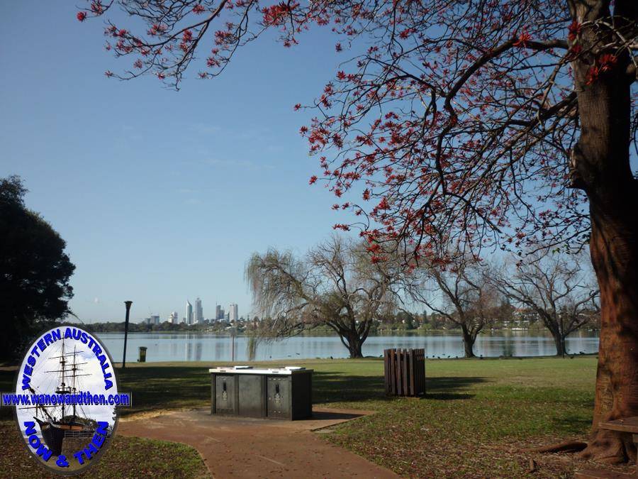
There are a number of places to park around the lake which is an ideal spot for a picnic or a BBQ.
The walk trail follows the shore of the lake and continues round in a loop so it doesn't matter where you start and end your stroll.
From the western end of the lake you will get some nice views of Perth City in the background.
King's Park
Time: 1.5 hours
Time: 1.5 hours
Time: 1.5 hours
Time: 2.5 hours
Whiteman Park Bush Walking Trails
Distance:
Whiteman Park offers a lot more than just bush walks. Check out the website for more information.
Rottnest Island heritage trails
Guided walks take place on Tuesday, Thursday and Saturday at 11:00am
Guided walks take place daily at 11:15am
Guided walks take place daily at 1:00pm and 2.30pm
Vlaming Lookout and Salt Lakes Walk
Guided walks take place on Friday and Sunday at 11:00am
Oliver Hill Guns and Tunnels Tour
Guided walks take place daily at 11:00am, 12 noon, 1:00pm and 2:00pm
Distance: 3.5km loop
Located at the end of Tidewater Way in Ascot, this walk is situated on an island in the Swan River.
Drive on to the island over the bridge and park on the left hand side.
There is a bitumised central trail that leads around the central open space and an outer gravel path that allows you to get closer to the water.
Strangely there are no toilet or BBQ facilities in what would otherwise be a perfect location for a picnic. There are shelters and seats dotted along the paths but other facilities are lacking.
Distance: 1km loop
Sandwiched between the Freeway and Mounts bay Road, this attractive little park is all but unknown to many people. Car park access is from Mounts Bay Road.
Despite the fact that thousands of people drive right by the park every day, few take the time to stop and have a look at what is there.
The park is very attractive and includes a lake, bridges and a waterfall area.
Despite being almost in the centre of Perth, the park is a haven for birdlife and you will see many water birds that make their home here.
Distance: 1.9km loop
Access from the eastern lane of the Causeway in Perth.
The car park is on the opposite side of the road to the most interesting part of the island although there are no signs to tell you about this.
Part way along the western side of the island is a fence, the fence is to keep in a population of kangaroos that live here.
Enter through the gate and you can continue on to where you will find a statue of the Aboriginal warrior Yagan. There are some seats and shelters in the park.
Distance: .9km return
Located on the corner of Karnup and Baldivis Roads.
The car park is on the opposite side of the road to the walk trail. The car park area was once the site of the Karnup school and now there is a picnic area with BBQ, shelters, seats and tables.
This is an easy walk through pleasant bushland. There are a variety of wildflowers in spring and plenty of birds for those who are interested in bird-spotting.
A gateway on the north side of Karnup road is the access point for the trail. Although there were once interpretive signs along the trail, most have now faded and need replacing.
Check out WalkGPS for detailed information on many Walk Trails - Perth and surrounds
|
|
Become a supporter of this website for just $5 a month
|


