|
Situated near the tip of Onslow in one of the ship's boats and were rescued by the
SS Burrumbeet. The anchor that now sits near the lighthouse came from the Mildura.

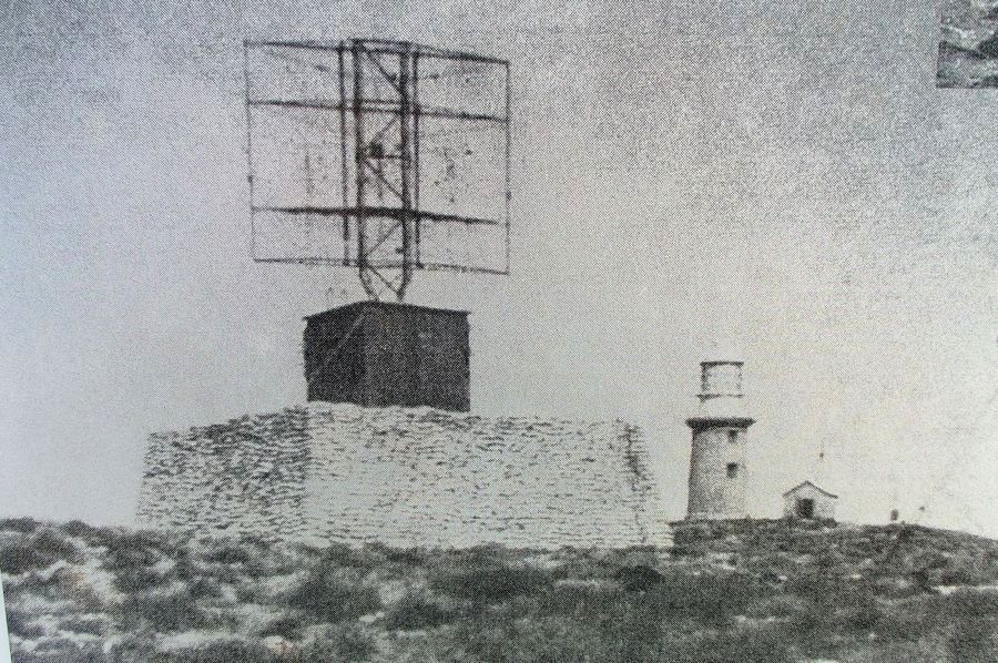
The cape was the site of an allied submarine base during World War 2 and near where the lighthouse stands was a gun battery and radar station.
The radar tower and sandbags can be seen in the photo below.
On May 20th 1943 the AA guns opened up as the radar station was attacked by Japanese aircraft. 36 rounds were fired from the 4 gun battery.

The radar stations were also used to track civilian QANTAS flights as they entered Australian airspace after flights from Ceylon (Sri-Lanka) that could last as
much as 30 hours.
A squadron of Kittyhawk fighters were based at Learmonth and a number of radar stations with AA guns were installed to help protect the area.
After the war an oil exploration company (WAPET) found oil in Cape Range but the deposits were not in commercial quantities. One lasting benefit of the exploration
was the road up through the range at Charles Knife Canyon. Charles Knife was one of the exploration team.

Time Line of the North West Cape
1618 : Dutchman Haevik Claezoon van Hillegom records a sighting of the cape.
1696 : Dutchman Willem Vlamingh charts the head.
1801 : Frenchman Nicolas Baudin names the area Cape Murat.
1818 : Phillip King surveys the cape and names Exmouth Gulf.
1818 : French ship Uranie visits the cape.
1876 : A cyclone destroys pearling luggers and 69 men drown.
1886 : Charles and George Brockman take up the first pastoral leases.
1907 : SS Mildura wrecked.
1912 : Lighthouse begins operation on December 10th.
1942 : Operation Pot Shot - building defences for the cape during WWII begins.
1946 : Radar station ceases operation.
1953 : Oil found on Cape Range.
1963 : Harold E. Holt communications station constructed.
1987 : Lighthouse caravan park opens. Lighthouse keeper's house becomes the manager's residence.

Check out our other VIDEOS
NEW **** CLICKABLE VIDEO MAPS **** NEW
Best time to visit:
|
Jan
|
Feb
|
Mar
|
Apr
|
May
|
Jun
|
Jul
|
Aug
|
Sep
|
Oct
|
Nov
|
Dec
|
|


