|
The City of Albany should be congratulated for its progressive attitude to camping within its boundaries. There are numerous free campsites in
the shire and as yet there appears to be no conflict with caravan parks trying to get free campsites closed down. Not only is the area historic
and scenic but the range of camping facilities is unrivalled anywhere in Australia.
SHELLEY BEACH (West Cape Howe)
GPS Ref: 35 06 32.28 S 117 37 46.49 E
Phone for information: 08 9842 4500
Time Limit: Unknown
Warnings: STEEP DESCENT. National park.
Restrictions: No dogs, No caravans, No big rigs.
Location details:
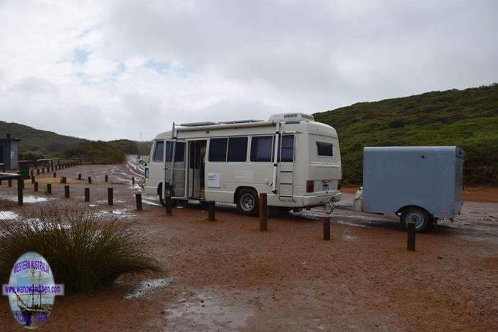
Shelley Beach is located west of Albany. This is perhaps the best campsite on this coast but no access for big rigs or caravans.
Small motorhomes and camper trailers only. Hang gliding launch ramps are on the cliffs above. CALM administered site so NO DOGS.
Check access FIRST if you intend to go to this site and are unsure about getting your vehicle down to the beach as the road is narrow and winding.
Access is as per the directions to Cosy Corner (below) but turn right before the road goes down to the beach and follow the signs to
Shelley Beach / West Cape Howe. The first part of the road is sealed but goes up a VERY STEEP hill. The last part is unsealed and can be
corrugated at times. The last section down along the cliffs is a bit hair raising but is fine in a standard car and should be okay for small motorhomes.


Check out our other VIDEOS
NEW **** CLICKABLE VIDEO MAPS **** NEW
COSY CORNER (East)
GPS Ref: 35 03 53.16 S 117 38 35.55 E
Phone for information: 08 9841 9333
Time limit: 1 week.
Warnings: None.
Restrictions: None known but too small for anything but campervans.
Location details:
Access from Lower Denmark Road and Cosy Corner Road west of Albany. Look for a sign to an unsealed road on the left. This site is better suited
to campervans, camper trailers etc. as there isn't a lot of room.
Difficult to get a site here as it is too well known.


LOWLANDS
GPS Ref: 35 04 28 S 117 31 18 E
Phone for information: Unknown
Time limit: Unknown
Warnings: Not an official campsite.
Restrictions: Probable day use only
Location details:
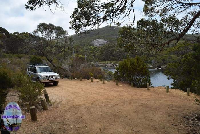
West of Albany. Access via Lower Denmark Road turn south on to Tennessee South Road. The lookout area is big enough for a small-medium
sized van or two but is uneven. The lower area (pictured) would be Ok for a campervan but don't crowd out the locals as space here is limited.
Access road in is unsealed. Possible overnighter for desperate motorhomers.


MUTTONBIRD
GPS Ref: 35 02 47 S 117 41 42 E
Phone for information: Unknown
Time limit: Unknown
Warnings: Not an official campsite.
Restrictions: Day use only
Restrictions: Probable day use only
Location details:
Located west of Albany. NO LONGER AVAILABLE FOR CAMPING. Access from Lower Denmark Road turn south into Elleker - Grasmere Road.
then take Mutton Bird Road. The road in is now sealed all the way.


TORBAY INLET
GPS Ref: 35 02 22.82 S 117 40 47.79 E
Phone for information: Unknown
Time limit: 1 week
Warnings: Some soft sand on access road.
Restrictions: Big rigs may have problems if crowded.
Location details:
Located west of Albany. Access via a gravel track with one or two boggy patches. Limited space (2-3 vans), but a lovely campsite by the inlet.
Head west from Albany along the Lower Denmark Road. Turn left (south) into Perkins Beach Road, (gravel) then take the next left. This
leads to the inlet.
Because this site is close to town it can attract the 'wrong sort of camper'.


Check out our other VIDEOS
NEW **** CLICKABLE VIDEO MAPS **** NEW
GULL ROCK (Ledge Beach)
GPS Ref: 35 01 00 S 118 00 30 E
Phone for information: Unknown
Time limit: Unknown
Warnings: Not an official campsite.
Restrictions: Probable day use only
Location details:
The area at the west end of Ledge Beach has been modified and is no longer really suitable for overnight stays. Space for perhaps one Coaster
sized vehicle to pull in for a night but sadly this is no longer such a good spot. Follow Lower King Road out to Gull Rock Road. Where the Road
turns to gravel take the first right hand turn to get to Ledge Beach. (Going straight on leads to Gull Rock which is probably a better alternative
for an overnight stop but there is a very faded NO CAMPING sign on the way out to this spot.)
There is a day use car park at the east end of Ledge Beach where a short walk down leads to one of the best beaches in the area.


TWO PEOPLES BAY (East Bay)
GPS Ref: 34 56 16.88 S 118 10 47.75 E
Phone for information: Unknown
Time limit: Unknown
Warnings: Sign posted as NO CARAVANS
Restrictions: Unknown
Location details:
This is signposted as 'no caravans'. Small vans are seen using the site but the road out is steep and unsealed. It is a very nice spot
with room for 3-4 motorhomes. Big rigs Should STAY AWAY!
Access is from South Coast Highway 38 kilometres east of Albany. Turn south into Homestead Road and look continue along past Norman's
Inlet turn off to a fork in the road. The Left hand fork leads to Betty's Beach (see below) and the right hand fork leads to East Bay.
The road in can be rough and access to both Betty's Beach and East Bay is very steep.


Check out our other VIDEOS
NEW **** CLICKABLE VIDEO MAPS **** NEW
BETTY'S BEACH
GPS Ref: 34 56 20 S 118 12 25 E
Phone for information: Unknown
Time limit: Unknown
Warnings: Steep descent.
Restrictions: Closed to camping during salmon fishing season. (Feb-Apr).
Location details:
Small area used as a commercial fishing settlement from February to April. (No camping during this time.) A very pretty spot near a
small bay. Room for 6-8 caravans. Steep descent. More open to wind than East Bay.
Access details as per East Bay above.


Check out our other VIDEOS
NEW **** CLICKABLE VIDEO MAPS **** NEW
NORMAN'S INLET (Beach)
GPS Ref: 34 55 16.73 S 118 12 51.08 E
Phone for information: Unknown
Time limit: Unknown
Warnings: None.
Restrictions: Not suitable for big rigs.
Location details:
This is a small area with limited room to turn at the end of the road. Not recommended for big rigs. Room for 2-3 vans only. Some soft sand in some
spots so be careful.
Access is from South Coast Highway 38 kilometres east of Albany. Turn south into Homestead Road and look for a left hand turn signposted
'Normans Beach'. Continuing straight on will take you to East Bay and Betty's Beach.


WAYCHINICUP
GPS Ref: 34 53 34.99 S 118 20 01.47 E
Phone for information: 08 9842 4500
Time limit: Unknown
Warnings: National Park site.
Restrictions: No dogs. Only suitable for campervan sized vehicles and tents.
Location details:
65Km E of Albany via South Coast Highway and Cheynes Beach road. Access down an unsealed road west from Cheynes Beach Road. Officially
tent camping but campervans will fit into parking bays. The inlet is one of the most spectacular spots on the coast. Tent sites are secluded and
shady, some have beautiful views.


CAPE RICHE
GPS Ref: 34 35 52.15 S 118 45 02.08 E
Phone for information: 08 9847 3088
Time limit: Unknown
Warnings: Road in can be very rough.
Restrictions: No dogs. Private campsite near by takes dogs but is more expensive.
Location details:
Access from South Coast Highway turn south into Sandalwood Road at Wellstead. 18Km of unsealed road. Very nice campsite. Campers
with dogs can stay on private property nearby but the cost is higher. Although big rigs can get to this site there are not really any camping
spaces suitable if it is busy. Good shop at Wellstead. Generators are allowed at this site.
Lack of signs to tell you what to do if the caretaker isn't around. Sites are NOT clearly marked. Charges for this campsite are rather high.


|


